With two weeks of vacation fast approaching, we pressed through the first iteration of our Ford Transit Connect van conversion. We had originally planned to use the first week of vacation to finish the conversion, and travel for the second week, but we realized that if focused on the conversion on weekends and evenings, we could extend our roadtrip into a longer, more epic Quebec roadtrip.
The original vacation was planned to be a week of camping in the Saguenay region of Québec. We had a lovely campsite booked on the rocky shore of the St. Lawrence river that is known for whale sightings.
But with an extra week, we could make our way out to the Gaspé peninsula (or Gaspésie). And that was fortunate, because while in Gaspé, our Saguenay camping reservation was cancelled due to rising COVID-19 cases, giving us extra flexibility to wing the final leg of the Quebec roadtrip.

Contents
Day 1 – Driving to Montreal


We left Toronto on a Tuesday morning, stopping at Action Scuba in Montreal to fill our scuba tanks and renew our Québec scuba licences, since we planned to dive either in Gaspé or Les Escoumins. Since we had lived in Montreal for 10 years, we didn’t plan on spending any time in Montreal, but rather focus on everything else in the beautiful province. But if you do have some extra time, check out our favourite things to do in Montreal.
We spent the first night of our Quebec roadtrip on the side of a rural road just east of Montreal. It was dark and rainy, but we made it through out first night without a hitch. The weather cleared up in the morning and we had a nice day ahead. As we left Montreal, we stumbled across an old covered bridge, the Balthazar bridge.

Day 2 – Eastern Townships of Quebec (with autumn colours)
Being October and prime fall colour season, we took the tourist route through the Eastern Townships of Québec. We made our way through Magog and Sherbrooke before making our way up highway 112 towards Québec City. This is a stunning area to visit in October to see the leaves changing stunning shades of orange and red.


While we had plans for the key destinations we wanted to hit, the exact schedule was flexible. If we enjoyed a place, we stayed longer. But if we exhausted a destination early, we moved on. We also favoured backroads so that we could better enjoy the scenery and discover cute little towns.
We stumbled across the town of Thetford Mines, a town that had previously thrived on asbestos mining. Several large tailings (giant piles crushed rock and debris from mining activity) remain as surreal reminders of this history. Not necessarily a classic tourist attraction, but very fascinating and happy we discovered it. And getting off the main highway took us through some amazing scenery.

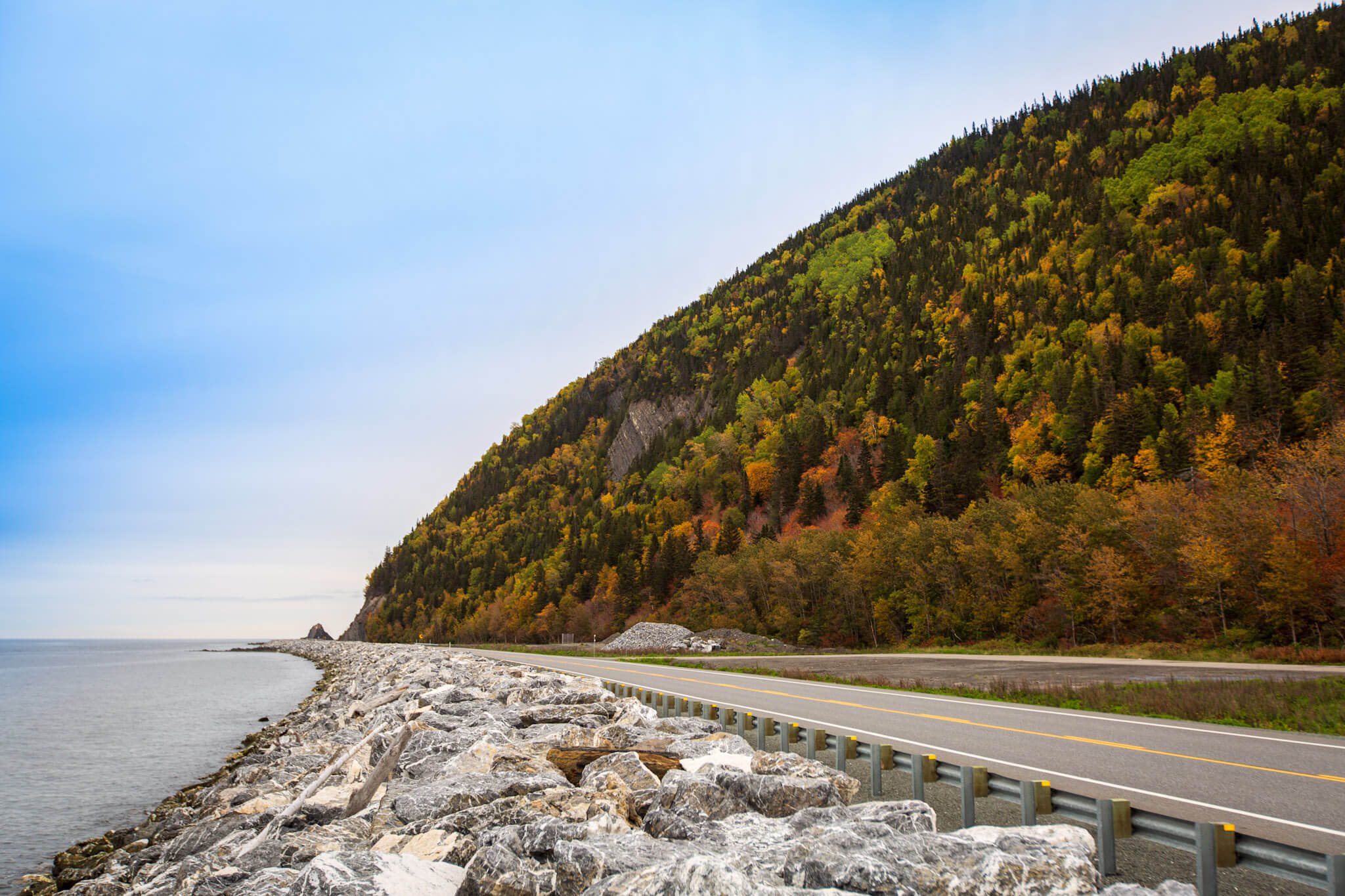
We rejoined the main highway at Québec City and continued along the coast of the St. Lawrence through to the tip of the Gaspé peninsula. Much of the highway skirts along the waterfront, passing through one quaint village after another, with breathtaking landscapes around every corner. Luckily, there are frequent areas to pull off to take photos (or a bathroom break).

As we started planning our sleeping spots, we quickly discovered that Québec has a culture of municipal campgrounds or RV stops. Some allow tent camping while others are purely for RV and vans; some are free while others charge a nominal fee.
For our next night, we stayed at the RV stop in Berthier-sur-Mer, just east of Québec City. It has become one of our favourite overlanding stops, with beautiful views of the St. Lawrence river and a great BBQ food truck.


Day 3 – Scenic Highway 132


Since we weren’t in a hurry, we continued our Quebec roadtrip eastward on Highway 132, the older, slower highway that tends to hug the St. Lawrence river, as opposed to the faster divided Highway 20. Highway 132 goes through picturesque villages and countryside, and offers more opportunity for pitstops.
Empress of Ireland museum at the Pointe-au-Père maritime historic site


For an interesting detour, stop at the Empress of Ireland museum at the Point-au-Père maritime historic site, just east of Rimouski. The museum tells the story of the tragic end of the Empress of Ireland in 1914, marking the worst maritime disaster in Canadian history. The site is also home to the 1909 Pointe-au-Père lighthouse, Canada’s second-tallest lighthouse.
We spent the next night in hospitable town of Saint-Ulric, which allows 24-hour RV parking at its municipal boat ramp. The boat ramp was closed, but the RV parking was open and free. And directly on the St. Lawrence river with great sunsets. While there RV parking doesn’t offer any services, a nearby park has washrooms.


Days 4-6 – Forillon National Park
From Saint-Ulric, we made our way to the tip of Gaspésie, where we decided to stay in the Petit-Gaspé campground at Forillon National Park. This is when our camping reservation in Saguenay got cancelled, so we decided to spend an additional two nights in Forillon and explore the park more thoroughly. At that, we could have easily spend a few more nights here because the park offers some some great hiking. Just means we need to return on our next Quebec roadtrip.


Definitely check out Cap Bon Ami for stunning rock formations and sea views. Cap Bon Ami can be accessed by hiking or by car.
For some interesting history, also check out the Fort Peninsula underground fortifications, a fully preserved World War II shore battery that protected the Gaspé Bay.


Scuba diving at Petit Gaspé beach in Forillon National Park
While in Forillon, we noticed signs for scuba diving. With a bit of research, we learned that you can scuba dive from the shore of Petit Gaspé beach, just steps away from our campground. So we geared up and hit the water, taking a compass bearing straight out into Gaspé Bay. We some some amazing seaweed and anemones.


Day 7 – Percé rock and southern Gaspésie
From there, we circled the Gaspé peninsula, passing through Percé (with the famous Percé rock) and driving trough the more mountainous south side of the peninsula. Normally we would have been tempted to cross over to New Brunswick, but the provincial border was effectively closed due to COVID-19.
Unfortunately most municipal and private campgrounds on the southern side of the Gaspé peninsula had closed for the season, so we ended up staying our first night in a parking lot (with permission). Thank you, Canadian Tire!


Enjoy the sea views in Carleton-sur-Mer before taking the Highway 132 loop back up to the St. Lawrence river at Mont-Joli near Rimouski.


Day 8 – Cap-de-Bon-Désir whale observation centre
Back at the St. Lawrence river, we took the ferry from Rivière-du-Loup to St-Siméon to explore the Saguenay Fjord region. The Rivière-du-Loup—St-Siméon ferry was the only ferry crossing the St. Lawrence river in 2020 due to COVID closures, but normally there would also be a ferry from Trois-Pistoles to Les Escoumins. The rest of our Quebec roadtrip continues along the northern shore of the St. Lawrence river and the Saguenay fjord region.
We had hoped to scuba dive again at Les Escoumins in the St. Lawrence estuary where the freshwater and seawater mix to create a rich ecosystem. But the off-season hours for the Marine Environment Discovery Centre are Friday through Sunday, and our new itinerary had us there mid-week. Again, just another reason to return to the area.


While on the road between Tadoussac and Les Escoumins, we noticed a Parks Canada sign for the Cap-de-Bon-Désir Interpretation and Observation Centre. This wasn’t on our radar, but we’ve come to learn that most Parks Canada destinations are worth a visit. Cap-de-Bon-Désir reinforced that belief. A short walk through the woods takes you to a stunning granite waterfront whale watching location. While the landscapes alone are worth a visit, we also saw several minke whales. A parks interpreter is stationed at the shore to help spot and identify the whales.
Days 9-11 – Saguenay Fjord National Park
The Saguenay Fjord National Park (technically a provincial park) offers some of the best views of the fjord, from drive-up views to hiking lookouts to adventurous via ferrata rock climbing. The park encompasses a large section of the fjord, on both the north and south sides. We focused on exploration of the park in the Baie Éternité sector, on the southern side of the fjord, halfway between the St. Lawrence river and the city of Saguenay.
Statue hiking trail


The Statue hiking trail (Sentier de la Statue) is a intermediate-to-difficult hiking trail that starts at the Baie Éternité discovery centre. It’s a 7.6 km roundtrip trail with an elevation gain of 280 metres, so budget 3-4 hours. There’s a lovely lookout halfway through the hike (Halte Bellevue) but for the most impressive views, continue to the end where you reach a rocky summit with a statue that overlooks the fjord.
L’Anse-de-Tabatière

For great views of the Saguenay fjord without a hike, drive to the lookout at l’Anse-de-Tabatière. Interpretive signage explains how the fjord was formed, and why the north and south sides of fjord look different.
Via ferrata


During our stay in the park, we participated in our first via ferrata rock climbing adventure. Via ferrata (Italian for iron path) is a rock climbing system that uses permanently installed steel cables, rungs and ladders, allowing even first-timers (like us) to climb some pretty challenging cliffs. We opted for the intermediate difficulty Grande Dalle trail that includes some vertical cliff climbs, a suspended ladder (the most terrifying part for me), a rope bridge and long wooden foot bridge. It was equal parts thrilling, terrifying, and breathtaking. I’d highly recommend it. If you’re unsure, consider the beginner level Passerelle trail.
Day 12 – Chicoutimi
From the Saguenay Fjord National Park, we started our return journey home which took us through the city of Saguenay. We wandered into the old town centre of Chicoutimi, which merged with Jonquière and La Baie to form Saguenay in 2002.


As we drove through Chicoutimi, we discovered an interesting city with a number of sights. The old pulp mill, the Pulperie de Chicoutimi, is definitely worth a visit. It was once the largest pulp producer in Canada. Wander through the various ruins of this once massive enterprise. Throughout the city are a number of hydroelectric dams, taking advantage of the rivers and streams that were critical to the former pulp mill.
Near the town centre is the “little white house”, a notable small white house that miraculously survived the disastrous Saguenay flood in 1996. Over 8 feet of water flooded parts of Chicoutimi and levelled parts of the city while this house survived.
Days 13-14 – Return drive
With our Quebec roadtrip at its end, from Saguenay-Chicoutimi we started our return trip taking Highway 175 that goes due south to Quebec City, then making our way through Montreal and back to Toronto.
This was an absolutely epic roadtrip through Quebec, and a great sampler of what La Belle Province has to offer. And I would do it all over again at the drop of a hat.
Have you been to any of these locations? What was your favourite? If you have any other sights and attractions to recommend, please share them in the comments below.
Leave a Reply